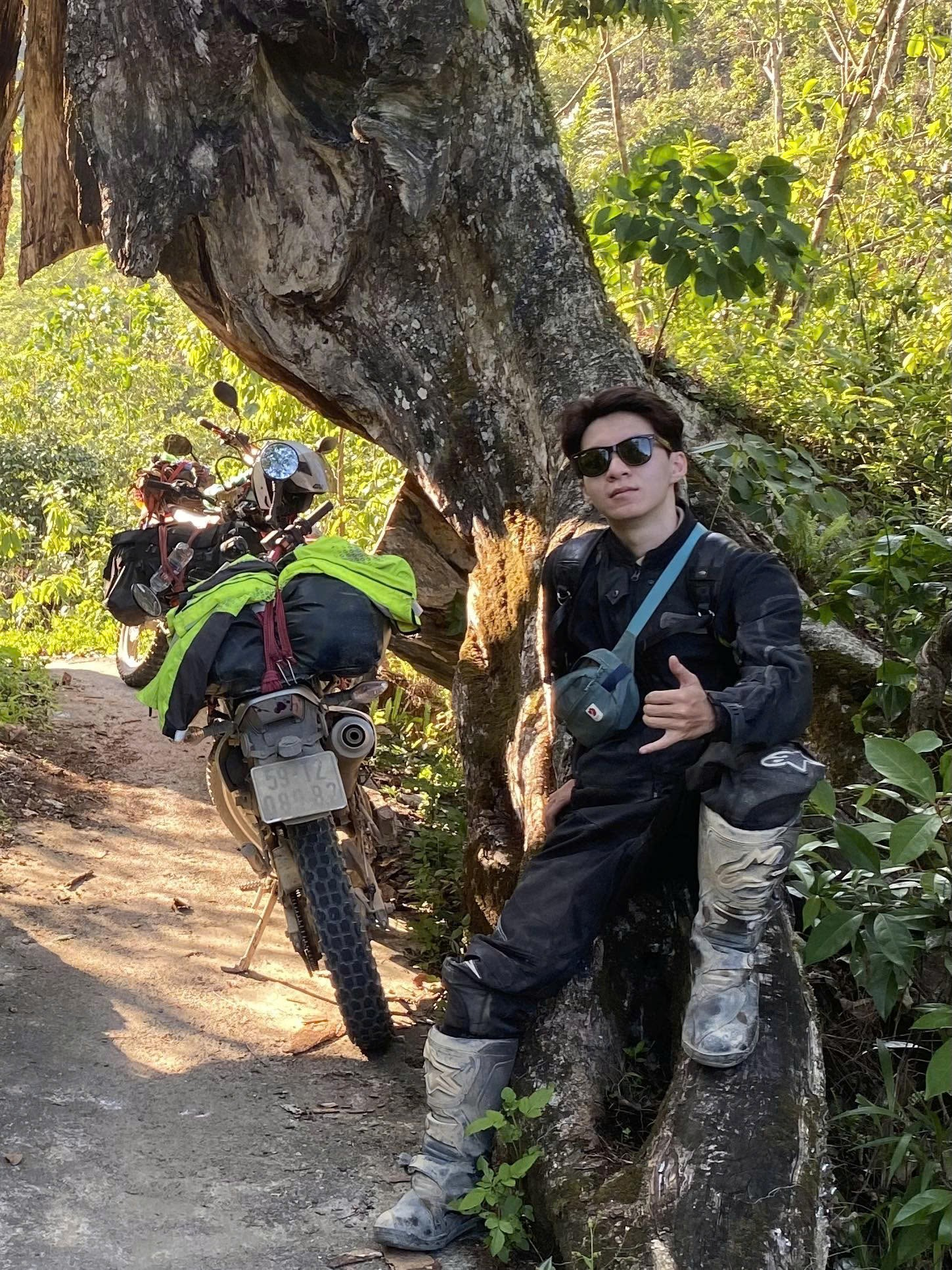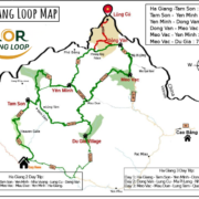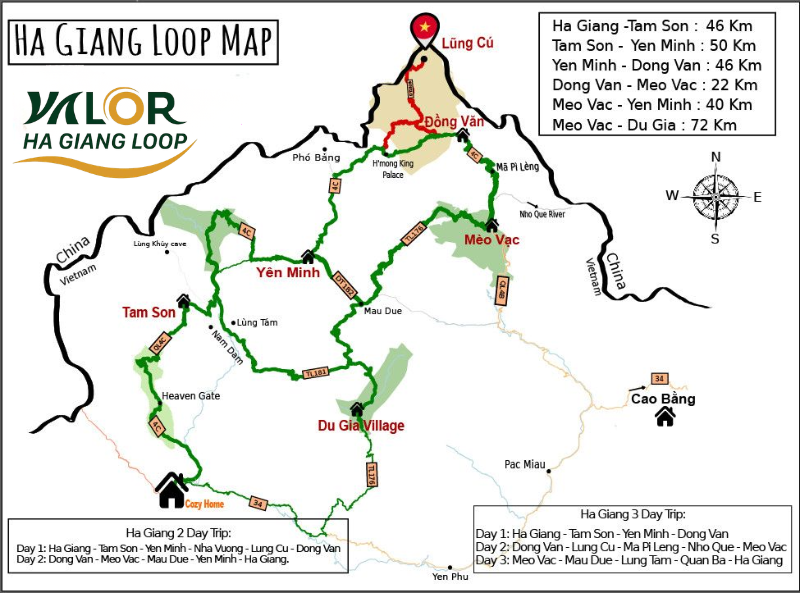
Looking for a detailed Google Map of Ha Giang Loop with scenic stops to plan your adventure? With Valor Ha Giang Loop, you’ll get more than just directions you’ll discover carefully selected viewpoints, hidden photo spots, iconic landmarks like Ma Pi Leng Pass and the Nho Que River, plus recommended overnight stops along the route. This complete Google Map will help you navigate confidently, ride safely, and make the most of every breathtaking moment on the legendary 350km journey.
Table of Contents
Overview of Ha Giang
Ha Giang is Vietnam’s northernmost province, bordering Cao Bang to the east, Yen Bai and Lao Cai to the west, Tuyen Quang to the south, and China to the north. Ha Giang City, the provincial capital, is located about 320 km from Hanoi and serves as the starting point for the famous Ha Giang Loop adventure. With its dramatic limestone mountains, breathtaking passes such as Ma Pi Leng, and iconic landmarks like the Quan Ba Twin Mountains, Ha Giang has long been a dream destination for nature lovers and motorbike enthusiasts.
Explore Tour at Valor
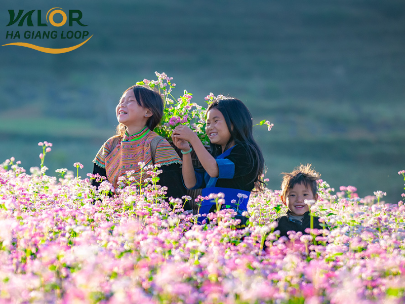
As a mountainous province, Ha Giang enjoys a cool climate year-round, with average temperatures ranging from 21-23°C, significantly lower than the lowland areas. Travelers can visit at any time of the year, but autumn (October-December) is often considered the most beautiful season, when buckwheat flowers and mustard blossoms cover the rocky plateau. Spring is equally enchanting, with plum and apricot blossoms blooming across the hills, creating a dreamy landscape that feels like floating among the clouds.
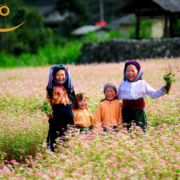
Beyond its stunning natural scenery, Ha Giang is home to 19 ethnic minority groups, each with its own unique cultural identity and traditions. The region’s cuisine is another highlight, featuring distinctive mountain spices such as mắc khén (wild pepper), cardamom, star anise, and forest honey, which give local dishes their rich and memorable flavors. The harmonious blend of majestic nature and diverse cultural heritage makes Ha Giang one of the most unique and rewarding destinations in northern Vietnam
Discover the Top 4 Most Beautiful Ha Giang Loop Routes
Ha Giang – Tam Son Route: A Short but Impressive Journey
The Ha Giang – Tam Son route is one of the most scenic and easiest sections on the Ha Giang Loop map, making it especially suitable for a 1-2 day motorbike trip. At an elevation of around 1,000 meters above sea level, this route offers fresh mountain air and sweeping views of endless limestone ranges. Although the distance is relatively short, riders can still fully appreciate the poetic beauty of the rocky plateau particularly during harvest season, when terraced fields are covered in vibrant shades of green.
The ideal time to experience this route is from October to December, when buckwheat flowers bloom across the hillsides, creating a romantic and captivating landscape. Beyond its natural beauty, the Tam Son area is rich in ethnic minority culture. Travelers can witness traditional festivals such as the Cow Fighting Festival or the Rain-Praying Ceremony, and visit the Quyet Tien weekend market, where locals dressed in colorful traditional costumes gather to trade mountain produce and goods.
Tam Son town is also home to several famous attractions, including Quan Ba Heaven’s Gate, the Quan Ba Twin Mountains, the Hmong Cultural Village, and the Nam Dam Community Tourism Village. Staying in a traditional Hmong house provides an authentic glimpse into highland life. Though short, the Ha Giang – Tam Son route delivers a memorable journey filled with natural charm and cultural richness
Tam Son – Yen Minh Route: A Poetic Mountain Journey on the Ha Giang Map
The Tam Son – Yen Minh route is one of the most beautiful and beloved sections on the Ha Giang Loop map, especially for motorbike enthusiasts. From Tam Son town to Yen Minh, riders travel along winding mountain roads surrounded by dramatic limestone peaks, breathtaking scenery, and ethnic minority villages. This stretch captures the true spirit of the rocky plateau both challenging and deeply inspiring.
The best time to experience this route is from October to December, when buckwheat flowers bloom across the hillsides, creating the iconic pink-purple landscape of late autumn in Ha Giang. The contrast between delicate flowers and rugged gray mountains offers an unforgettable visual experience for anyone passing through.
One of the standout stops along the way is Yen Minh Pine Forest, where travelers can enjoy the cool mountain air, misty roads, and towering pine trees. It’s also an ideal place to capture photos of traditional H’Mong and Tay houses nestled among the hills. You can also combine the journey with a visit to Du Gia Village, known for its peaceful atmosphere, pristine nature, and turquoise waterfalls a perfect resting point after a long day of riding.
Beyond its landscapes, the area is famous for its unique highland cuisine. Local specialties such as au tau porridge, buckwheat cakes, and men men (steamed corn flour) are prepared using traditional methods and mountain spices, reflecting the authentic flavors of ethnic minority communities. The blend of nature, culture, and food makes the Tam Son – Yen Minh route an essential part of any Ha Giang adventure.
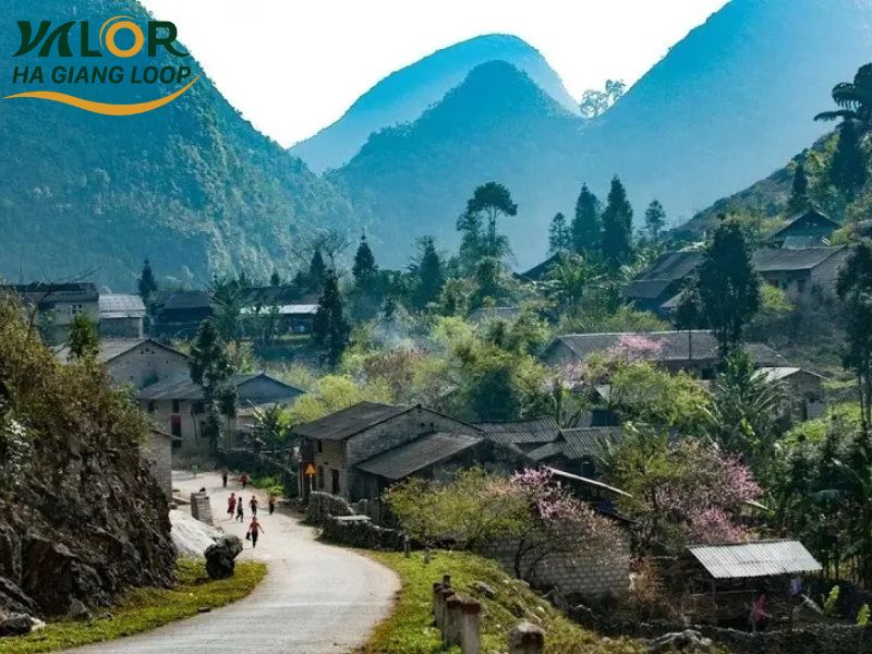
H’Mong ethnic village near Yen Minh
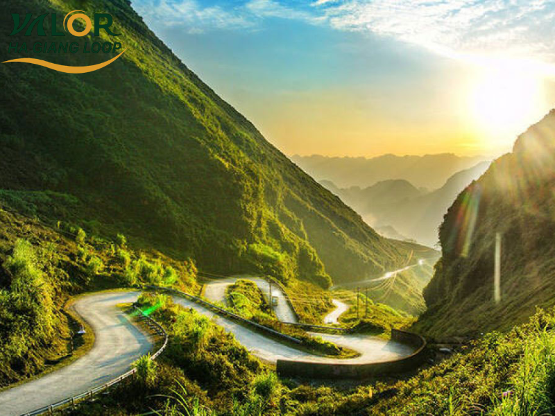
Yen Minh – Dong Van – Lung Cu Route: A Challenging Journey on the Majestic Ha Giang Loop Map
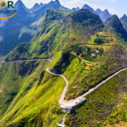
The Yen Minh – Dong Van – Lung Cu route is considered one of the most impressive and challenging sections of the Ha Giang Loop. The terrain here is rugged, featuring towering limestone cliffs, winding curves, and consecutive steep mountain passes. Yet it is precisely this intensity that attracts adventure seekers and motorbike enthusiasts. The dramatic mountain roads and breathtaking scenery along the way create a powerful sense of achievement once the journey is completed.
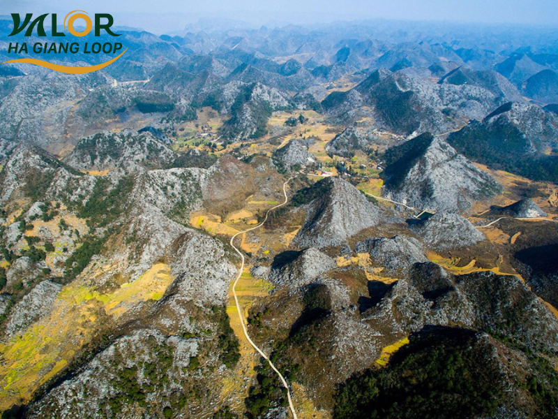
The Dong Van Karst Plateau is the highlight of this route. Situated at an elevation of 1,000 to 1,600 meters above sea level, this UNESCO-recognized geopark preserves remarkable geological formations and rich cultural heritage. Travelers can explore the historic Dong Van Old Quarter, with architecture dating back to the French colonial era, while also admiring endless stretches of rugged limestone mountains. The harmony between majestic landscapes and the slow-paced life of ethnic minority communities creates a deeply captivating highland atmosphere.
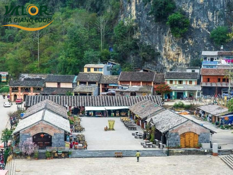
Dong Van Old Quarter in the heart of the rocky plateau
The journey concludes at Lung Cu, the northernmost point of Vietnam. Standing atop the Lung Cu Flag Tower, visitors can take in panoramic views of layered mountain ranges and experience the peaceful simplicity of small houses nestled in the valleys below. It is a symbolic destination that many travelers dream of reaching when visiting Ha Giang.
In addition to its scenery and culture, local cuisine adds another layer of charm to this route. Specialties such as smoked buffalo meat, Dong Van rice rolls, Bac Me bamboo rice, and five-colored sticky rice are prepared using traditional mountain ingredients like mắc khén (wild pepper) and forest herbs. These rustic yet flavorful dishes offer unforgettable culinary experiences as part of your exploration of the Dong Van rocky plateau.
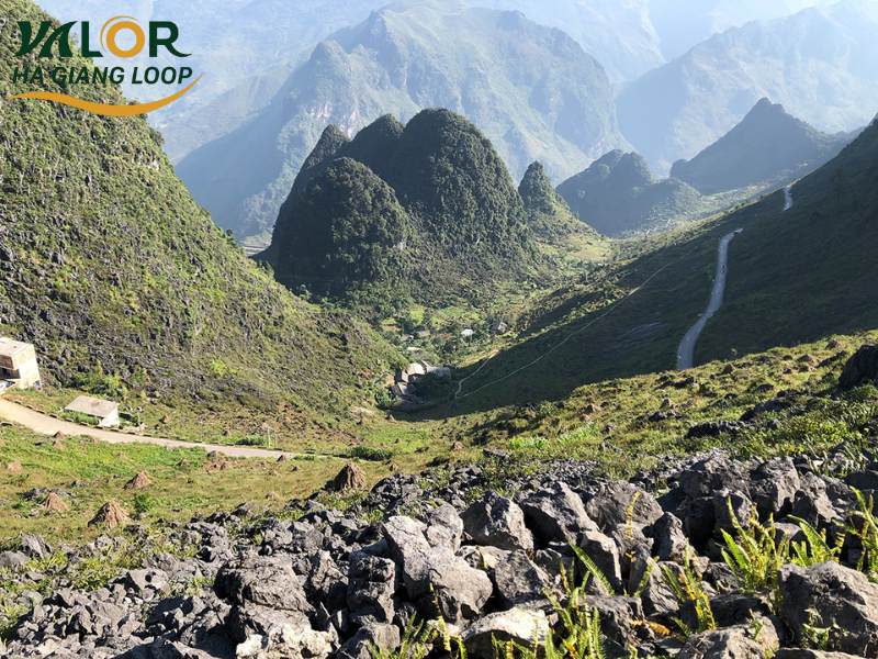
Dong Van – Meo Vac – Du Gia Route: A Peaceful Journey on the Ha Giang Loop Map
The Dong Van – Meo Vac – Du Gia route is one of the most emotional and visually striking sections of the Ha Giang Loop. This journey takes you through the heart of the Dong Van Karst Plateau, where rugged mountain landscapes blend harmoniously with the simple lifestyle of ethnic minority communities. Beyond its dramatic scenery, the Dong Van and Meo Vac areas captivate travelers with long-standing traditions and the peaceful atmosphere that defines life in the highlands.
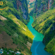
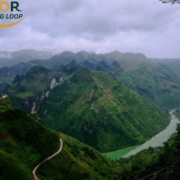
The most iconic highlight of this route is Ma Pi Leng Pass, connecting Dong Van and Meo Vac. Known as one of the most dangerous yet most beautiful mountain passes in Vietnam, Ma Pi Leng offers breathtaking views of towering limestone cliffs, golden terraced fields during harvest season, and the emerald Nho Que River winding far below. Conquering this stretch delivers both challenge and reward an unforgettable sense of achievement for motorbike enthusiasts.
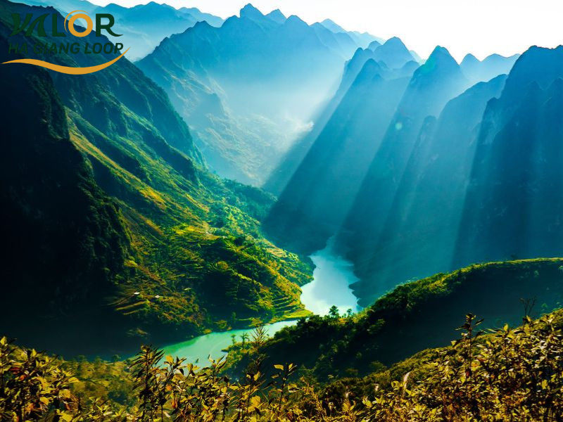
Ma Pi Leng Pass overlooking the Nho Que River
From Meo Vac to Du Gia, the 70-80 km ride continues to test riders with winding and uneven roads. The Meo Vac – Sung Tra section can be particularly demanding, especially in foggy conditions. However, the reward lies in the raw natural beauty along the way, with cornfields stretching up steep hillsides and lush greenery flourishing after seasonal rains.
Arriving in Du Gia, you’ll experience a peaceful valley town that feels worlds away from the dramatic mountain passes. It’s an ideal place to rest after challenging riding days. Visitors can enjoy hiking, camping, village walks, or relaxing at Tham Luong Waterfall, where crystal-clear water provides a refreshing break
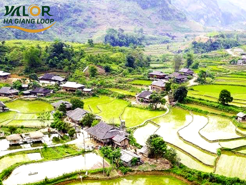
Peaceful Du Gia Village nestled in the valley
The Ha Giang Loop is far more than a line on a map it is a journey through majestic landscapes, tranquil villages, and the rich cultural heritage of the rocky plateau. No matter which route you choose, each section offers unique emotions and unforgettable scenery. With a carefully prepared Google Map of Ha Giang Loop from Valor Ha Giang Loop, you can navigate safely, discover the best scenic stops, and fully enjoy this legendary adventure.
See more: